Geo electric soil models are needed as input for many types of studies. The values have a linear effect on earthing resistances and soil potentials and are predominant for the outcome of studies, so you have to be sure that you use proper soil models. What if we tell that they are all wrong?
Geo-electrical soil models
A geo electrical soil model is typically based on measurements. The measured (resistance) values are converted to apparent soil resistivities. If a value for different depths are available, they can be inverted into a 2D multi-layer model. Even 3D soil models can be determined, showing layers and zones. However, to do this you will need to perform many measurements at multiple locations and use special software to get suitable results.
Now, geo-electric soil measurements are relatively easy to perform. There is a variety of methods, all with their own advantages. What is not easy to do, is determining a suitable soil model. It might even be the most difficult step in a study, since there is simply not one way to do this right. Ask different people to come up with a model and they might all give different answers. Now, how to handle this problem?
Purpose of the model
First, the purpose of the soil model should be clear: for what type of study will it be used? For example, to calculate local soil potentials (e.g. in a substation), the upper layer is a bit more important than the lower layers, although they all play a role. But if you want to calculate soil potentials at a greater distance (e.g. to determine resistive influencing) the deeper layers are predominant. And to calculate line impedances, a (less accurate) single value of the soil resistivity is sufficient. Of course, all this is depending on the object or situation that is under review.
It can be that for one and the same location, you end up using a different soil model per purpose.
If you have measurement results and use them as input for a soil model, you can choose a suitable approach along the way. But, if you have an existing model you should be careful to just apply this in other studies.
So it can be that for one and the same location, you end up using different soil models. Maybe one model to determine the tower footing resistance for a short circuit study, another model to calculate the resistive influence of a short circuit in this tower, and a third model to analyse the touch voltage of the tower.
It is an art, not a science
The theory for the collection of information (performing measurements) and translating this into a soil model is available and may provide you with multiple-digit accurate results. There will however always be hidden factors that have an influence on the final result, and it’s exactly these factors that need to be taken into account. Especially when a situation is reviewed for a period that should comply to requirements or regulation over a longer time, say 40 years. Therefore you can say: “Determining geo electric soil models is an art, not a science”.
Different types of measurements
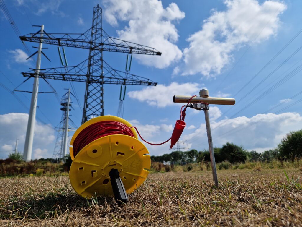
The input data typically comes from measurements, however different types of measurements can be performed, all requiring a different way of processing. Probably the most famous methods are the Wenner-method and the Schlumberger-method, but also the result of other (direct or indirect) measurements can be used to gain insight in the soil conditions. For example, the resistance measurements from single vertical electrodes can be calculated back to soil resistivity values, if measurements at different depths are performed.
Limitations of measurements
The analysis of electrode measurements, such as the Wenner- or Schlumberger-method, know some limitations in its use. For example: the analysis assumes homogenous soil resistivity distribution within each layer, and the layers are perfectly horizontal. Of course, in reality this will seldom be true. For that reason it is recommended to perform multiple measurements in the same area. If there is a large spread in the measurement results (and no objects are present that may influence the measurements) it may be that the local soil is inhomogeneous in terms of soil resistivity and layer build up.
Influencing factors
The analysis of measurement data should be done with care, since multiple factors might influence the outcome. Some of the most important are:
- Seasonal variation: three weeks of drought or two months of rain will absolutely have a great impact on the geo electric soil characteristics. Especially on the resistivity of the top layer, but up to a certain extent it may also influence lower regions in the soil. Also a change in the ground water level might impact the lower levels. These are the reasons that a clear description of the soil and weather conditions in every measurement report is recommended.
- Layer structure and irregularities: hardly any place on earth has a perfect uniform soil resistivity. This can be due to a non-uniform distribution of soil types (static irregularities) but also due to the influence of sunlight, wind and rain (dynamic irregularities). For some locations it can be the case that vertical layers and/or irregularities are present.
- Conducting objects near the location of interest (or in the vicinity of the measurement location) might influence the measurements. This can be a nearby earthing grid, pipe lines or other infrastructure, but also a trench or river that contains water. Depending on size of the object(s) and the distance to the measurement location, it may influencing the results.
- Generic measurement inaccuracy: every measurement performed has a certain (generic) degree of inaccuracy. Performing two measurements at the same location might already lead to somewhat different results. Although this might be only a small difference, it indicates that some degree of margin may be needed to take into account.
So what should you do if there are differences between two or more measurement profiles for the same location? Is it due to the mentioned influencing objects, local irregularities of the soil, or temporary influences?
So, how to do this?
As you understand, setting up a geo electric soil model is not that easy. In fact, if you review the work of someone else, you can always think of arguments to make different choices, affecting the outcome of the analysis.
The purpose of the model determines how to analyse data from soil measurements for a great part. The applied measurement method(s) may also require the user to make some choices during the process. It is advised to collect data from multiple measurements. If possible you may even want to compare results from different measurement methods. Anomalies shall be reviewed and might be deleted from the datasets. Based on the findings, it is recommended to take account for any influencing factors by rounding the values in the final model to somewhat higher numbers, both for resistivity values as for the layer thickness. To what extent of course depends on the situation and the purpose of the study.
If you want some more information on performing measurements and processing the measurement data into geo electric soil models? You may want to check this online course. It will give you more background information, tools for analysis, and practical examples.